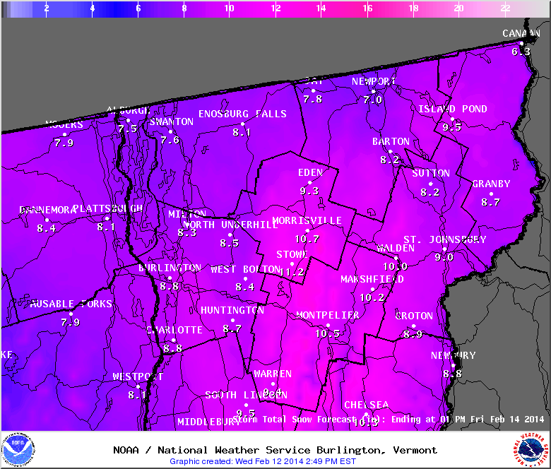
Last night when I turned in I thought the storm was a bust. However, when I got up this morning we had indeed gotten some snow. At 2pm light snow continues to fall on the NEK. Snow totals from around the region are between 6-14 inches with some other parts of the state recording up to 2 feet of snow! The highest total from around the NEK that I could find was 14 inches in Averill. Here in Island Pond we’ve received 8.5″ so far. The wind is really blowing it around creating white out conditions during some of the heavier gusts.
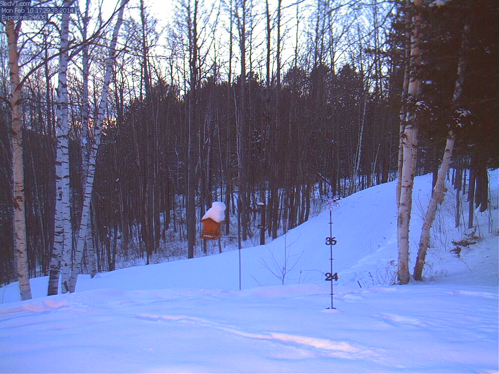
I was hoping to see the 24″ mark covered on thewebcam snow stake, but we didn’t manage to get enough for that. Oh well, there’s always tomorrow….
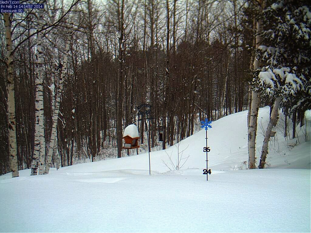
18 inch mark covered on the snow stake