Hard to believe it is February 10th already. Winter started slow, but has made up for it lately. It doesn’t seem like we’ve had many days without snow over the past several weeks. Mostly just an inch or two here and there, but we have had a couple storms lately that produced 6+ inches of new snow. I took a three different snow depth measurements as the level on the snow stake on the webcam seems low. The average of the three was 28 inches of snow.
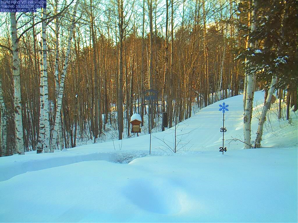
The snow depth on the webcam is a little under the 28″ average I found manually measuring.
All of New England has been getting lots of snow lately as you can see on the recent snow depth map.
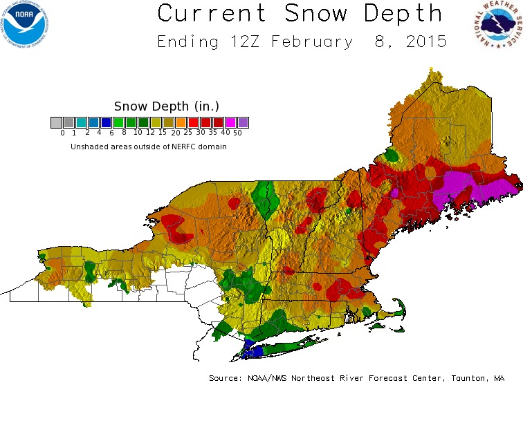
Northeast Snow Depth Map
I’ll end this post with a bit of sad news from here in Island Pond. Ted’s Market closed its doors yesterday. I was shocked to find out when I went in yesterday and found the place packed with people buying loads of groceries at 50% off. They always seemed busy to me and everyone there went out of their way to be helpful. Very sad to see 🙁