The past several mornings have been on the chilly side throughout the NEK of VT. This mornings low of 40.5 F was the coldest we’ve had here in Island Pond since June 22 when the temperature dropped to 38 degrees. On the the plus side the last few days have been beautiful with highs in the upper 60s to low 70s. The NWS forecast is calling for increasing clouds tonight with showers tomorrow. After the showers move through more cool air is on the way. Highs on Friday will only be in the low 60s throughout the Northeast Kingdom. We may even see a few 50s for highs in the cooler places like Coles Pond and other locations at elevation. Saturday morning will probably have most locations in the 30s. I wouldn’t be surprised to see scattered frost in some of the sheltered valleys.
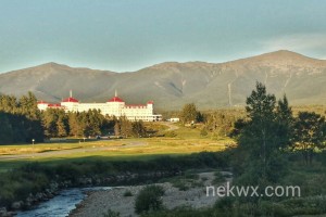
I’ll end this post with a photo of the Mt Washington Hotel that I took yesterday while in NH.

